It is important to conduct sector analysis before starting the design process. This will help us better understand the space we are designing and provide effective solutions that align with our wishes and needs.
Introduction / Background
Sectoral analysis is a tool used in permaculture to gather information for design. It is complemented by other analytical procedures, such as analyzing the 5 elements mentioned in the previous lesson. These procedures provide additional information about how natural and social phenomena influence the space we want to design.
Before conducting the sector analysis, we need to choose a reference point in space (or a specific, not too large area) for the analysis. If necessary, we can conduct the analysis for multiple points in space for the specific area we are designing.
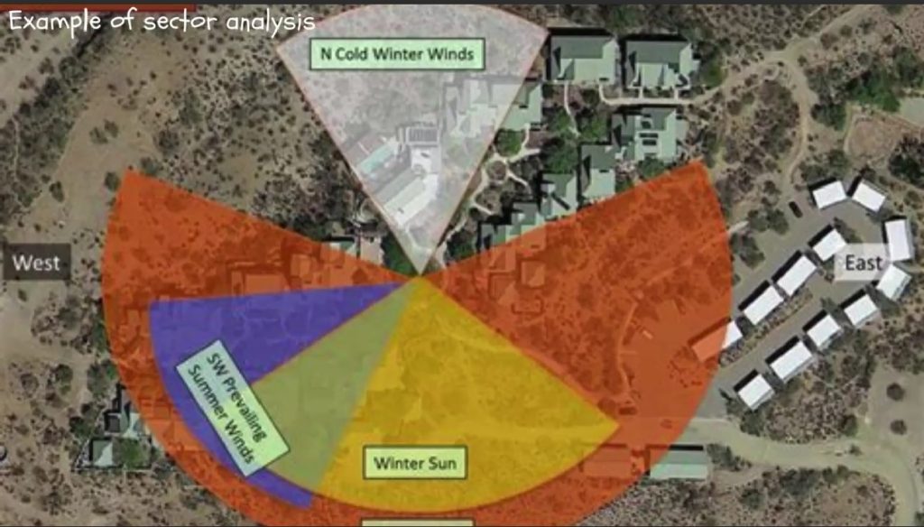
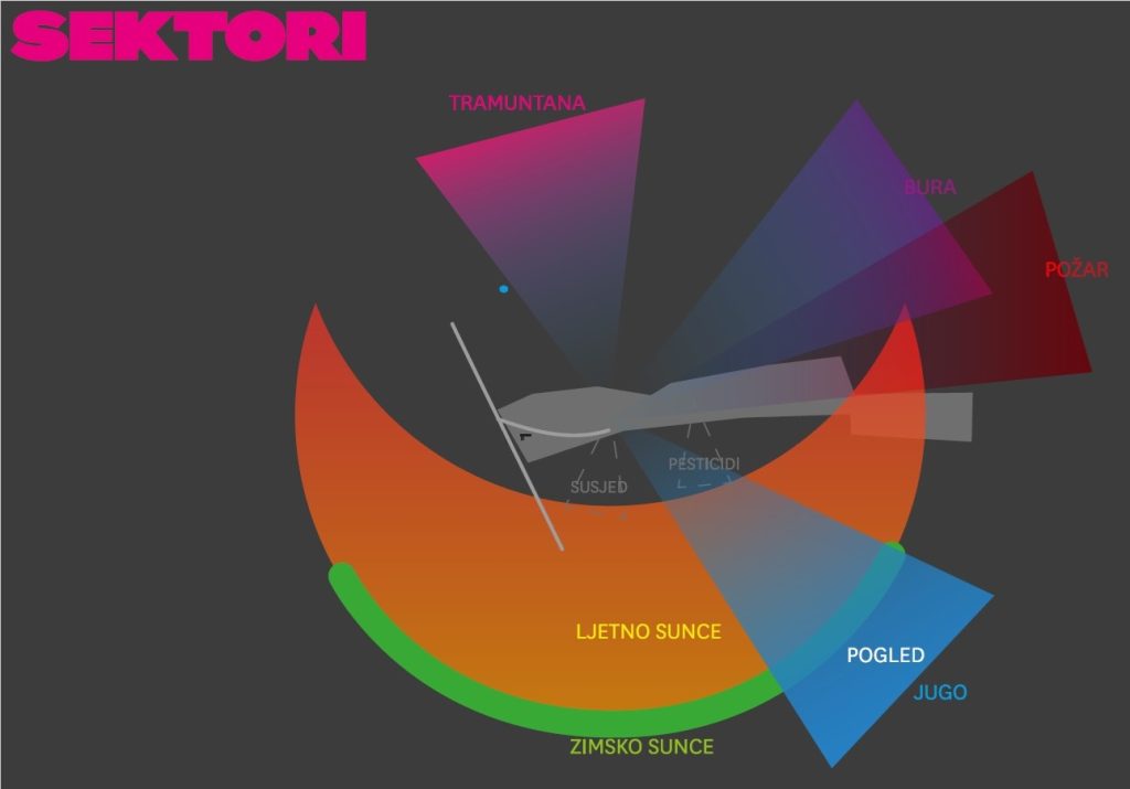
Starting from the chosen point, we observe all external influences acting on it. These influences are crucial because they impact the future use of the area. We consider influences from all directions, covering a full circle of 360 degrees around the reference point. The influences themselves can originate from one or more directions, or from a wider area.
We record these influences and often visually display them as lines or segments of a circle in the part of the circle from which they affect the observed area.
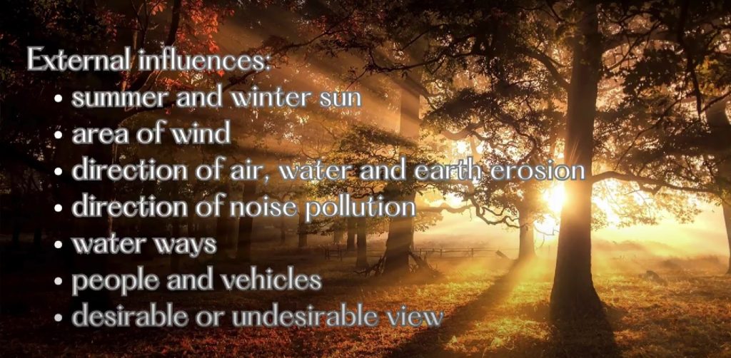
Please take note of the following influences:
The area influenced by the summer and winter sun.
The area influenced by each wind direction from the wind rose.
Direction of air, water, or erosion pollution.
Direction of noise pollution.
Direction of water entry.
Direction of movement (approach) of animals, birds, and insects.
Direction of the approach of people and vehicles.
The direction of fire danger.
Area of desirable or undesirable view…
Keep in mind that sectors of influence encompass all external influences that intersect the observed space, such as a road or a stream.
It’s important to understand the desired usage of the space and the necessary conditions in order to effectively utilize the information obtained through sector analysis.
We seek to embrace positive influences and leverage their beneficial traits by removing obstacles that may hinder their impact. Conversely, we aim to diminish or eliminate negative influences by introducing design elements that hinder their effect.
Sector analysis assists us in determining the location and type of design elements needed in the space.
Goal
Conducting a sector analysis that provides a clear visual presentation of the anticipated impacts on a specific area we are designing, whether they are desirable or undesirable.
Step by step
When conducting a sectoral analysis, we can do it in the classroom or out in the field that we are analyzing.
In the field, we use all our senses—sight, hearing, smell, and touch—as well as information from sources like the Internet, various applications, or literature such as atlases, encyclopedias, and maps. Additionally, people familiar with the terrain can provide valuable information.
To start the exercise, we introduce the concept and purpose of sector analysis to the students and explain the task—identifying and mapping sectors in the chosen terrain.
Start by selecting the terrain, preparing or drawing a terrain map, and defining the geographical position.
Draw a reference point on the terrain map.
Share the list of influences (sectors) and draw them on the prepared map as a task.
Draw sectors that can be recognized by the senses on the map.
Draw sectors that need to be explored through other sources (such as summer and winter sun, winds) on the map.
Define sectors that cannot be recognized or mapped due to lack of information and discuss how to obtain this information.
Ask if there are any other important influences that have not been mentioned.
Once all impacts have been identified, discuss the desirability of each individual impact on the purpose and use of the terrain.
Provide suggestions on how to address the established influences with concrete solutions and elements in the space.
Reflection questions
In sectoral analysis, what do we call the external influences on the sector we are analyzing?
What is the dominant influence in your sector analysis?
How does it affect the entire system?
Can we isolate just one influence and gain a true understanding of the situation based on that?
Is it possible to eliminate sector influences? If so, why and how?
Why do we perform a sector analysis?
What are the methods for conducting sector analysis?
Learning objectives
Familiarize yourself with sectoral analysis and its implementation method.
Recognize the importance of understanding external influences on our design area.
Learn how our design can influence external factors.
Preparation / materials / tools
A4 or A3 paper or terrain map
List of influences
Crayons
Ruler and compass
Nuggets
Here you can find nuggets that can help you implement the lesson.